

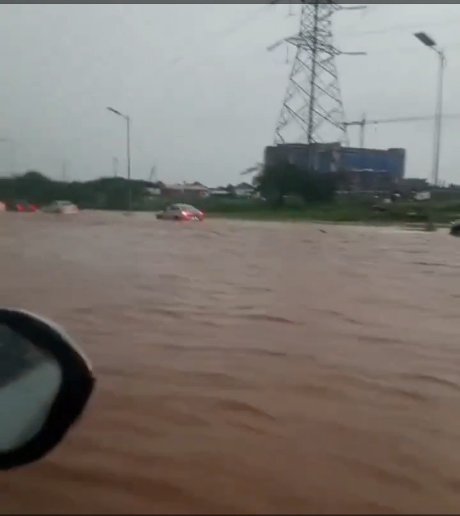
ABUJA — Residents of Lugbe and adjoining communities in the Federal Capital. Territory have once again been confronted with severe flooding, renewing concerns over the increasing distortion of Abuja’s original master plan and the development of structures around waterways and protected green areas. Lugbe has long been identified among Abuja communities vulnerable to flooding, with recent heavy rains affecting areas including Lugbe, Trademore, Lokogoma, Gaduwa, Durumi and other parts of the capital.
Trade More Estate, located in the Lugbe axis, has in particular become synonymous with Abuja’s recurring flood crisis, while residents have repeatedly raised concerns about drainage capacity, development patterns and the obstruction of natural watercourses.
The latest flooding has also intensified scrutiny of how the Abuja Master Plan has been implemented over the years. The city’s original planning framework incorporated green belts, open spaces, waterways and natural drainage corridors designed to accommodate stormwater and protect residential areas from flooding.
Critics argue that the conversion of some of these areas for construction has progressively weakened the city’s natural flood-management system. A recent analysis by the Policy and Legal Advocacy Centre also raised concerns about the alleged distortion of Abuja’s master plan through the conversion of green areas, flood waterways and reserved lands.
The controversy has become particularly pointed under the administration of FCT Minister Nyesom Wike, with critics questioning whether enforcement of planning regulations has been sufficiently consistent. However, it is important to note that the evidence does not establish that Wike personally authorised illegal structures in Lugbe. Indeed, his administration has recently ordered demolitions of structures obstructing designated waterways following the latest flooding.
Wike, after inspecting flood-affected locations, acknowledged that some property owners had blocked channels designated for water flow under the Abuja Master Plan. He subsequently directed that structures found on waterways be removed.
The FCT Administration has also begun demolishing structures obstructing drainage channels, initially in Maitama, with officials indicating that the exercise would extend to other parts of Abuja.
Experts have specifically linked the Lugbe flooding problem to the disruption of natural drainage routes running from the Apo-Wasa axis through Apo and into Lugbe. According to an environmental planning analysis cited by ICIR, obstruction or alteration of these natural channels can contribute significantly to flooding in Lugbe.
The unfolding situation therefore presents the FCT Administration with a difficult test: whether it will enforce the Abuja Master Plan uniformly, irrespective of the identity, wealth or political influence of property owners.
For residents of Lugbe, the question is no longer simply why Abuja is flooding. It is whether the capital’s carefully designed network of waterways, green areas and drainage corridors will be restored before more homes, businesses and lives are placed at risk.
As the rainy season continues, residents are demanding urgent clearing of waterways, proper drainage infrastructure and a comprehensive audit of developments sitting on designated flood channels and protected green areas.
**The floodwater may eventually recede, but the larger question confronting Abuja remains: who allowed the city’s master plan to be compromised, and who will now restore it?**